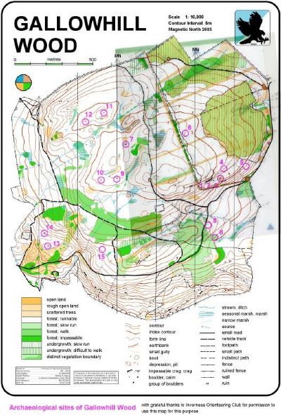
Gallowhill - North Kessock
| Record of visible Archaeological Remains in Upper part of Gallowhill Wood, North Kessock, Ross-shire, GR NH602498 25th January 2003 |
Archaeological Sites Record | |
| Site name and SMR or NMRS No. | Location |
| NGR NH 60640 49727 | Site type/class Enclosure |
| Situation and surroundings | |
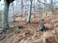
| Description | |
| On 1st Edition OS map or others No | |
| Sketches Yes | |
| Recorder, Date and Weather - J. Marshall, A. Mackenzie - 25.01.03. Weather - showery | |
| Comments, associated features, possible interpretation | |
Archaeological Sites Record | |
| Site name and SMR or NMRS No. | Location |
| NGR NH 60625 49717 | Site type/class Enclosure |
| Situation and surroundings | |
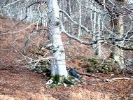
| Description | |
| On 1st Edition OS map or others No | |
| Sketches Yes | |
| Recorder, Date and Weather M. Marshall, A. Wakeling & A Wilson - 25.01.03. Weather showery | |
| Comments, associated features, possible interpretation | |
Archaeological Sites Record | |
| Site name and SMR or NMRS No. | Location |
| NGR NH 6060 4980 | Site type/class |
| Situation and surroundings | |
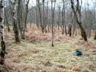
| Description | |
| On 1st Edition OS map or others No | |
| Sketches Yes | |
| Recorder, Date and Weather M. Marshall - 21.02.03. Weather - showery. | |
| Comments, associated features, possible interpretation | |